

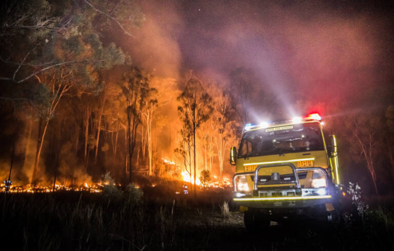
HERE Technologies and the NSW Rural Fire Service have integrated more than 60,000km of fire trails into an emergency response routing network, helping crews navigate beyond public roads to reach incidents in remote locations.
The initiative combines HERE’s road network data with NSW RFS operational mapping to create a unified, routable network incorporating fire trails, private roads and other critical access routes.
For heavy vehicle fleet operators, the project highlights the importance of mapping that reflects the routes specialist vehicles need to use, particularly when access extends beyond conventional road networks.
Closing the gaps in emergency navigation
NSW RFS protects approximately 95% of New South Wales and responds to thousands of incidents each year, including bushfires, grass fires, storms, search-and-rescue operations and vehicle accidents.
Getting crews and fire appliances to these locations often involves travelling along routes that are missing or insufficiently represented in traditional navigation systems.
Fire trails, off-road tracks and private roads have historically been difficult to capture, maintain and integrate into navigation-ready mapping databases. Combining the two organisations’ datasets helps address those gaps.
“Many of the routes used by emergency services every day are not conventional roads,” said Daniel Antonello, General Manager, Oceania, HERE Technologies.
Antonello said bringing together HERE’s location technology and NSW RFS operational intelligence would provide a more complete view of the road and trail network, helping responders navigate with greater confidence.
Connecting dispatchers and crews
The integrated fire trail network supports operational use through Computer Aided Dispatch (CAD) and Mobile Data Terminals (MDT).
This gives dispatchers and crews a more extensive view of the connections between public roads and operational access routes, supporting planning, preparation, response and recovery.
The enhanced mapping also supports vehicle-specific navigation for fire appliances, with route guidance intended to account for the requirements of emergency response vehicles.
For heavy and specialist fleets, that is a significant consideration. Identifying a route to a destination is only part of the task; operators also need to understand whether the route suits the vehicle and its operating requirements.
Bringing operational knowledge into the map
The collaboration draws on NSW RFS’ knowledge of the access network its crews use every day.
“Fire trails are a critical part of how we access and manage incidents across New South Wales,” said NSW RFS Acting Director, ICT and Chief Information Officer Matthew White.
White said combining that operational knowledge with HERE’s mapping technology would create a richer representation of the network.
“This helps improve situational awareness and supports more informed decision-making in the field,” he said.
The approach demonstrates how fleet operators’ own mapping data can improve the usefulness of commercial navigation systems, particularly where vehicles regularly travel beyond public roads.
A lesson for specialist heavy vehicle fleets
The implications extend to other heavy vehicle operations using private roads, remote tracks and restricted access networks.
For utilities, forestry, infrastructure maintenance and other specialist fleets, gaps in navigation data can complicate journey planning and access to work sites.
The NSW RFS initiative provides an example of how operational datasets can be integrated into a routable network, making local knowledge more accessible to dispatchers and drivers.
Keeping those datasets current remains essential. A more complete map supports better decisions, but reliable routing depends on maintaining accurate information about the network vehicles need to use.
For fleet managers, the practical starting point is to assess whether their navigation systems represent the full operating environment — including the access routes that sit beyond the public road network.